-
This 8 Days Kilimanjaro climbing Lemosho route offers a great acclimatization program. The Lemosho Route joins the Machame Route at Lava Tower and heads down towards Barranco Valley via the Southern Circuit. As with the Machame Route, Lemosho trekkers need to traverse the Barranco Wall and then summit from Barafu Camp.
Most trekkers complete the Lemosho Route in eight days; however, some travelers may climb Mount Kilimanjaro in seven-day treks and six-day hikes on the Lemosho. The 8-day variation is great for acclimatization and, of course, increases the probability of success. The seven-day route typically stops for a night at both Shira Camp 1 and Shira Camp 2. Eight-day treks stop again at Karanga Camp for another acclimatization day.
Each day of your trip is planned to give you amazing adventures and relaxing moments. You’ll explore beautiful places, see incredible wildlife, and experience local culture. Get ready to make great memories!
Departing from the hotel driving through welcoming mountainside villages to the Kilimanjaro National Park Gate. We will patiently wait for our permits to be issued while watching the hustle and bustle of operations as many crews prepare for the journey ahead Enjoy the beautiful rainforest scenery and windy trails while your guide tells you about the local flora and fauna and natural wildlife. At these lower elevations, the trail can be muddy and quite slippery. We highly recommend gaiters and trekking poles here.
After a good night’s sleep and a hearty breakfast, we emerge from the rain forest and continue on an ascending path, we leave the forest behind now, the trail climbs steadily with wide views to reach the rim of the Shira Plateau. Temperatures begin to drop.
We explore the Shira plateau for a full day. It is a gentle walk east toward Kibo’s glaciered peak, across the plateau which leads to Shira 2 camp on moorland meadows by a stream. Then we continue to Moir Hut, a little-used site on the base of Lent Hills. A variety of walks are available on Lent Hills making this an excellent acclimatization opportunity. Shira is one of the highest plateaus on earth.
Although you end the day around the same elevation as when you began, this day is very important for acclimatization. From Shira Plateau we continue east up a ridge, passing the junction towards the Kibo peak before we then continue, South East towards the Lava Tower, called the “Shark’s Tooth” (elevation 4650m/15,250ft). Shortly after the tower, we come to a second junction, which leads to the Arrow Glacier. We then continue to descend overnight at Barranco Camp.
We begin the day by descending into a ravine to the base of the Great Barranco Wall. Then we climb the non-technical but steep, nearly 900 ft cliff. From the top of the Barranco Wall, we cross a series of hills and valleys until we descend sharply into Karanga Valley. One more steep climb up leads us to Karanga Camp. This is a shorter day meant for acclimatization.
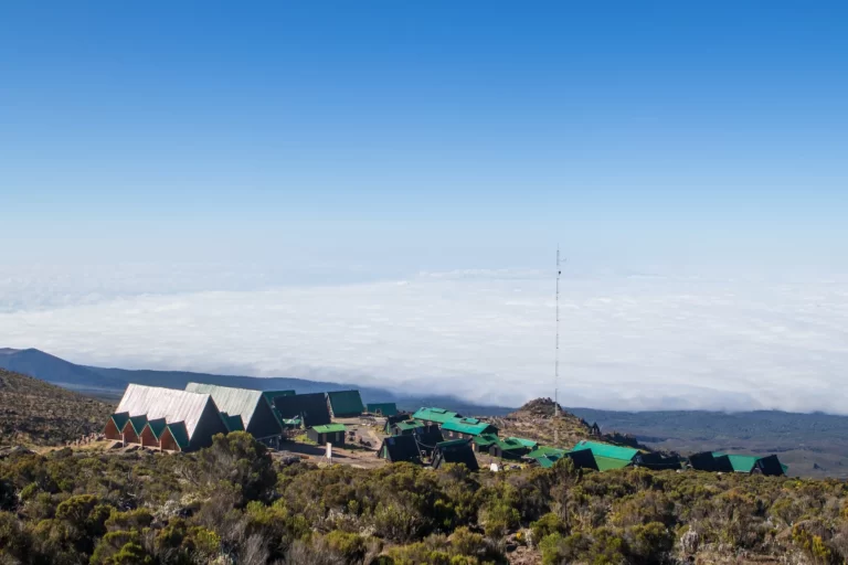
We leave Karanga and hit the junction which connects with the Mweka Trail. We continue up to the rocky section to Barafu Hut. At this point, you have completed the Southern Circuit, which offers views of the summit from many different angles. Here we make camp, rest, and enjoy an early dinner to prepare for the summit day. The two peaks of Mawenzi and Kibo are viewable from this position.
Very early in the morning (around midnight), we begin our push to the summit. This is the most mentally and physically challenging portion of the trek. The wind and cold at this elevation and time of day can be extreme. We ascend in the darkness for several hours while taking frequent, but short, breaks. Near Stella Point (18,900 ft), you will be rewarded with the most magnificent sunrise you are ever likely to see coming over Mawenzi Peak.
Finally, we arrive at Uhuru Peak- the highest point on Mount Kilimanjaro and the continent of Africa. From the summit, we now make our descent continuing straight down to the Mweka Hut camp site, stopping at Barafu for lunch. The trail is very rocky and can be quite hard on the knees; trekking poles are helpful.
Mweka Camp is situated in the upper forest and mist or rain can be expected in the late afternoon. Later in the evening, we enjoy our last dinner on the mountain and a well-earned sleep.
After early morning breakfast, you will start your ascend leaving the rain forest and entering the heathland moorland vegetation. In the moorland, you will spot exotic plants, including giant lobelia and groundsel. As you ascend, the trail provides a spectacular view of Mt. Kilimanjaro.
The trail then flattens then descends into the Barranco Valley until you reach Barranco Camp. At this campsite, you will be next to a stream and have a spectacular view of the Western Breach and the Great Barranco Wall in the East.
Pricing intended as a guideline. Subject to availability, airfare and rate of exchange fluctuations.