Day 1: Simba Camp
Day 2: Second Cave Camp
Day 3: Kikelewa Camp
Day 4: Mawenzi Tarn Camp
Day 5: Kibo Hut
Day 6: Uhuru Peak
Day 7: Marangu Gate
-
The Rongai route is the only route that approaches Kilimanjaro from the north, close to the Kenyan border. Though gaining popularity amongst climbers, this route still experiences low crowds. Rongai has a more gradual slope than the mountain’s other routes. It is the preferred route for those looking for an alternative to the popular Marangu route, for those who would like a more remote hike, and for those who are climbing during the rainy season (the north side receives less precipitation). Rongai is a moderately difficult route and is highly recommended, especially for those with less backpacking experience.
Although the scenery is not as varied as the western routes, Rongai makes up for this by passing through true wilderness areas nearly the entire way. Descent is made via the Marangu route.
Each day of your trip is planned to give you amazing adventures and relaxing moments. You’ll explore beautiful places, see incredible wildlife, and experience local culture. Get ready to make great memories!
Pick up from your hotel drive for two hours and a half to Marangu park gate for formalities registration after that transfer to the Rongai trailhead in about 3hours. Meet your guide and porters before you begin your hike from the Nale Moru village. The small winding path crosses maize fields before entering the pine forest and then climbs gently through a forest. The trail is not at all steep but is rather a gentle hike through the beautiful country. The first night’s camp is at Simba camp, at about 2,600 meters. There is a toilet and a wooden table with benches, but no hut. Water can be found just down the trail below samba camp.
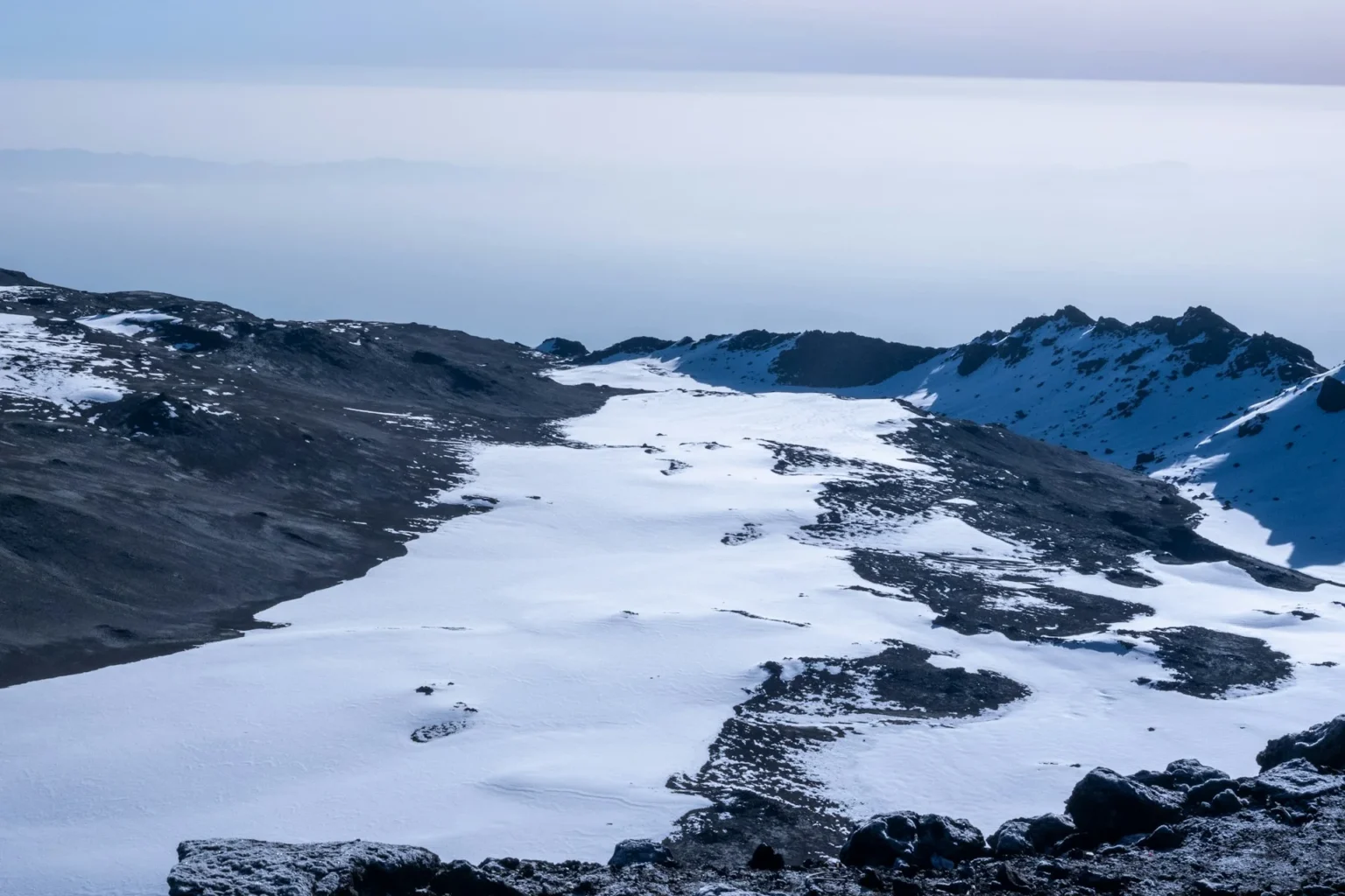
After a good night’s sleep and a hearty breakfast, we continue along moorland terrain on a consistent ascending path. You will catch some terrific views of Kibo and get your first glimpse of the ice fields on the Eastern crater rim. The small shrubs of the moorland became thinner as you approve the Second Cave. Temperatures begin to drop.
After breakfast then continues up towards Kibo, reaching Kikelwa Cave about 3600 meters. The views start to open up and you begin to feel you’re on a really big mountain! Water is in the obvious stream below the cave, although you might have to wander downhill a way to find some. Overnight at 3rd Cave camp (Kikelewa Caves).
A short but steep climb up grassy slopes offers superb views of this wilderness area. The vegetation zone ends shortly before you reach your next camp at Mawenzi Tarn spectacularly situated beneath the towering spires of Mawenzi. Spend the afternoon acclimatizing and exploring the area.
Continue ascending on the east side of Kibo crossing the saddle between Mawenzi and Kibo taking 4 to 5 hours to reach Kibo Hut. The remainder of the day is spent resting in preparation for the final ascent, which begins around midnight. Overnight at Kibo Camp.
You will wake up at midnight, and after some tea and biscuits you shuffle off into the night. This is where the going gets tough. The first section of the trail consists of a rocky path to the Hans Meyer Cave (5150m), also a good resting spot. The path then zigzags up to Gillman’s point (5 681m), which is located on the crater rim. This section is very steep with a lot of stone scree, requiring great physical and mental effort. Probably the most demanding section of the entire route.
From Gillman’s Point, you will normally encounter snow up to Uhuru peak (5895m), the highest point in Africa. Total exhilaration and satisfaction – you made it. Weather conditions on the summit will determine how long you can spend, taking photographs, before the 3-hour descent back to Kibo hut for a short rest ten after you descent to Horombo hut (3 hours) where you will overnight.
The descent to Horombo hut will seem surprisingly fast compared to the ascent. The total time spent walking on this day is around almost 14 hours, Later in the evening, you enjoy your last dinner on the mountain and well-earned sleep.
After breakfast and a heartfelt ceremony of appreciation and team bonding with your crew, it’s time to say goodbye, you continue your descent (6 hours), stopping at Mandara hut for lunch, then continuing descending to the Marangu gate. Remember to tip your guides, cooks, and porters, since you will be leaving them here.
At Marangu gate, you sign your name and details in a register. This is also where successful climbers receive their summit certificates. Those climbers who reached Gillman’s Point (5685m) are issued with green certificates and those who reached Uhuru Peak (5895m) receive gold certificates.
From the gate, a vehicle will meet you to drive you back to your hotel in Moshi (about 45 minutes). Enjoy a long overdue hot shower, dinner, and celebrations!!
Pricing intended as a guideline. Subject to availability, airfare and rate of exchange fluctuations.